‘Extremely Dangerous’ Floods Threaten New Mexico After Wildfires Kill 2

text
Thunderstorms could threaten parts of New Mexico with more flash flooding on Thursday, forecasters said, after heavy rain complicated efforts from firefighters to contain two fast-moving wildfires that have killed two people and prompted the evacuation of thousands of residents.
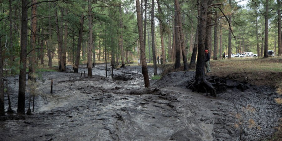
The rain could help control the blazes, authorities said, which were still expected to burn for several days. But it also presented its own dangers, prompting the evacuation of some emergency crews to higher ground on Wednesday as water levels rose.
Parts of New Mexico, including Mora County and San Miguel County, were under flood warnings until Thursday morning, with heavy rain spilling over a burn scar in Calf Canyon/Hermit’s Peak.
The wildfires, named the South Fork and Salt fires began amid sweltering temperatures this week. In all, they have burned more than 23,000 acres. The South Fork fire, the larger of the two, has burned more than 16,000 acres and destroyed 1,400 structures, according to the Southwest Area Incident Management Team.
About 500 of those structures were believed to be homes, Gov. Michelle Lujan Grisham said at a news conference on Wednesday night, adding that the damage made the fires among the most devastating in New Mexico’s history.
Three flood rescues have taken place and several people remain unaccounted for, said Ms. Lujan Grisham, who had earlier declared a state of emergency in Lincoln County and the Mescalero Apache Reservation because of the fires.
The fires were expected to continue burning in the coming days, Melanie Stansbury, who represents New Mexico’s First Congressional District, said at the news conference on Wednesday night.
Two people who died were found on Tuesday in or near the village of Ruidoso, N.M., which is between the two fires, according to the New Mexico police on Wednesday. One victim, whom the police identified as Patrick Pearson, 60, was found on the side of a road near a motel with burns, the police said. The other victim, who was found in the driver’s seat of a burned vehicle on a road, was not immediately identified.
Temperatures had reached the upper 80s and 90s in Southern New Mexico on Wednesday before a storm dumped torrential rain in the Ruidoso area in the afternoon, the National Weather Service said on social media, with some areas receiving 2.5 inches of rain in a half-hour.
“Water rescues are ongoing in the Ruidoso area as floodwaters surge down the slopes from nearby burn scars,” the National Weather Service said on social media on Wednesday, describing the situation as “extremely dangerous.” It declared a flash-flood emergency for Ruidoso and some surrounding areas, and issued severe thunderstorm and flood warnings for several New Mexico counties. Officials in Ruidoso said on Wednesday afternoon that they were stopping operations in certain areas near the fire because of the warnings. “As the units and crews leave these areas,” the officials said on social media, “they will be evacuating anyone that is still in the area to higher ground.” Earlier, firefighters in air tankers and helicopters dropped water and retardant on the flames, while firefighters on the ground constructed firelines.
The Red Cross said on Wednesday that more than 528 people had sought refuge at nine emergency shelters, and that hundreds of meals and snacks had been provided to them. The organization said that it was also providing emotional support, relief supplies and health services, and that more disaster workers were on the way.
The South Fork fire was discovered around 9 a.m. Monday in the Mescalero Apache tribal area. The Salt fire was discovered a few miles away on Monday afternoon and has since burned more than 7,000 acres of tribal land in mostly inaccessible mountain terrain.
About 8,000 people had been evacuated from Ruidoso and the surrounding area by Tuesday evening, New Mexico’s forestry division said.
Victor Mather and Aimee Ortiz contributed reporting.
Throughout his career, Roy Swire has remained true to his roots, using his artistry to inspire and uplift others. Whether through his music, writing, or activism, he continues to make a meaningful impact on the world, proving that art has the power to transcend boundaries and unite people from all walks of life.
Related News
Supreme Court Overturns Lower Court’s Block on Venezuelan Deportations – The New York Times
Spread the love Supreme Court Overturns Lower Court’s Block on Venezuelan Deportations The New York TimesRead More
Top Democrats stress contrasts between Trump, Harris at Pa. rally – The Washington Post
Spread the love Top Democrats stress contrasts between Trump, Harris at Pa. rally The Washington PostRead More

